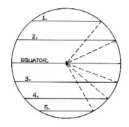
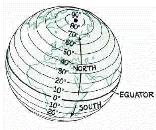
1. degrees
2. degrees
3. degrees
4. degrees
5. degrees
6. Equator = degrees
Latitude and Longitude
Part I:
Use a protractor to determine which latitudes are drawn on the following map of the earth.
(Note: All of your angles will be less than 90.)
1. degrees
2. degrees
3. degrees
4. degrees
5. degrees
6. Equator = degrees
Part II:
Determine the coordinates of all of the squares occupied by ships in this "Battleship" grid. Record your answers as a number and letter combination such as 6H, 5C, etc.
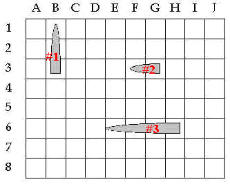
Battleship #1, ,
Battleship #2 ,
Battleship #3 , , ,
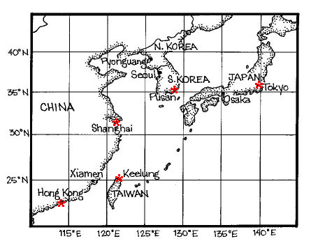
Part III: Latitude and Longitude - Determining coordinates for cities.
Give the latitude and longitude locations for each city.
Part IV: Latitude and Longitude - My Location
Use the above information to fill in the boxes on the web page for the Census Bureau's "U.S. Gazetteer" and then hit SEARCH.
Record your location here. Don't forget N or S for latitude; E or W for longitude. (Forget about the minutes and seconds--just give the whole number.)
Latitude: Longitude:
Click here to see the map you should have found.
Part V: Two types of grid systems
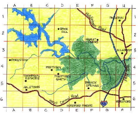
The map below uses a system of number and letters.
What is located at these points?
| 2D | 1H | 4A | 4F |
A simple grid system that uses squares doesn't work so well on the round earth. So the earth has been given a special grid, made up of lines called latitude and longitude.
The map below uses a system of latitude and longitude lines.
What is located at these approximate points?
(Latitude always comes first.)
| 40N, 4W | 60N, 25E | 50N, 8E |
| 48N, 16E | 43N, 12E | 52N, 0 |
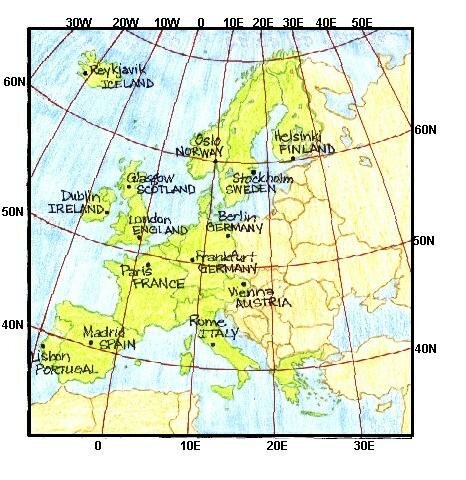
What is the approximate location of Paris?
What is the approximate location of Lisbon?
What is the approximate location of Stockholm?
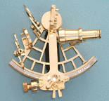
Part VI: Think about it!
How did sailors long ago know their positions out in the middle of the ocean?
They knew that the height of the sun at noon was different for each latitude. They used several different tools to measure this height: an astrolabe, a cross-staff, a quadrant, an octant, or a tool called a sextant, pictured below.
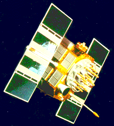
As technology improved, it became much easier to find exact locations. The United States began launching satellites for navigation in late 1959. Lots of different satellites were launched into orbit throughout the 1960's. Today, the Global Positioning System consists of 24 satellites in orbit around the earth. This is a GPS satellite.
And here are the 24 GPS satellites in orbit around the earth.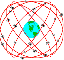
Each of the satellites send radio signals from space, which can be picked up with GPS receivers and provide very precise locations. But GPS can give more than just latitude and longitude; it can also give altitude and other information. So GPS is very useful for aircraft as well as ships. Not to mention use on land! And a small GPS receiver can be purchased for less than $200, making it quite affordable for many people and uses.
What uses can you think of for GPS today?
1.
2.
3.
4.
Give up? How did you do? Click here for some answers.
Today GPS is used for navigation by military ships and aircraft, as well as commercial ships and aircraft, and recreational boats and planes.
GPS is also now being used on land for navigation and tracking of many trucking fleets. GPS is being tried out in cars for navigation and traffic control systems. GPS is also being used by hikers and backpackers, field scientists, and others, to keep track of their positions so they don't get lost.
GPS is used by the military for intelligence and target location, as well as weapon aiming and guidance. GPS is being used by many in the science community for research purposes. It is used in atmospheric research, geological research, oceanographic research, and wildlife research.
GPS is being used by commercial industries to increase precision in time measurements, as well as determining locations for mapping and surveying. It is being used to increase public safety by helping direct policemen, firemen, and ambulances, as well as search and rescue teams.